Facility owners responsible for the maintenance and repair of parking lots understand the critical importance of proper lighting. Safety considerations and operating costs compete for the top spot on every facility owner’s list of ongoing priorities.
For schools, hospitals, auto dealerships, and retail outlets, the exterior lighting maintained by the facility needs to be crisp, bright, and cost-effective. This should be easy enough to verify just by walking around and looking up at a facility’s exterior lighting fixtures, right?
Well, maybe, if that’s the best you can do.
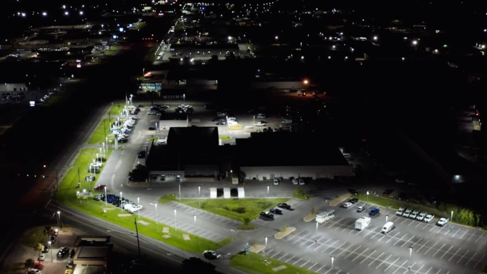
For an increasing number of lighting contractors, the true gold standard of evaluation for a facility’s exterior lighting begins and ends with drone photography. The view from hundreds of feet in the air leaves little room for doubt when it comes to assessing nighttime lighting conditions.
Drones are fairly common these days. In just a few short years, aerial photography has become a mainstream technology that is easily attainable and understandable for everyone, not just high-tech trendsetters.
Let’s take a quick look at one of the most valuable tools available for facility owners interested in accurately evaluating the effectiveness of their business’s exterior lighting.
From Hobby to Mainstream
It is not uncommon to see hobbies come and go. Stamp collecting and paint-by-number enthusiasts are still out there somewhere, but they’re not as cool as they used to be.
However, some hobbies stick around and grow into much more than simply a weekend pastime. This is what has happened to remote-controlled drones, the fun and affordable technology that has brought aerial photography to the masses.
Since 1858, when Frenchman Gaspar Félix Tournachon took the first aerial photograph from within a tethered hot air balloon just outside Paris, aerial photography has shaped and informed modern history. This macro view has allowed us to perceive the true scale of natural disasters and has provided valuable intelligence to military planners during times of war and peace.
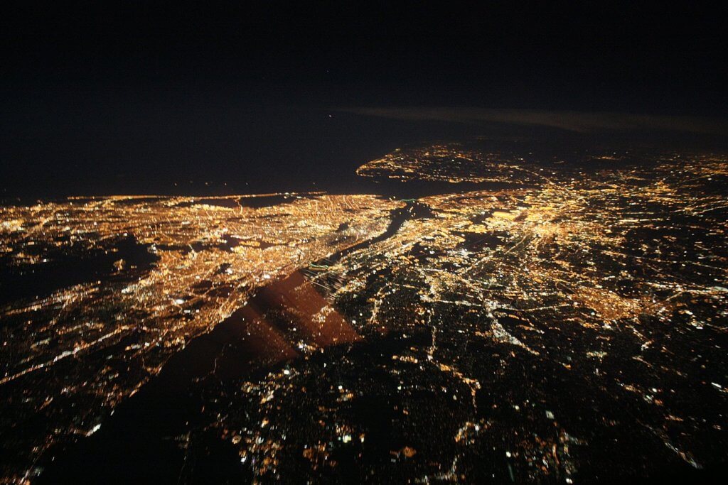
However, around the year 2000, the downward views that were previously only available to aircraft pilots and military strategists started to become accessible for regular citizens with an interest in a bird’s eye view. Beginning with the DIY remote-controlled model airplane community, a steady march of improvement and innovation has resulted in a booming industry offering drone photography for almost any budget and skill level.
With hardware and software improvements that make the earliest models seem crude, today’s drone technology features autopilot, flight path programming, collision detection, high-resolution cameras, and onboard stabilizers to deliver the sharpest and most controlled images ever available in the 160-year history of aerial photography.
Flying High and Saving Money
The truth is, today’s drone photography is more affordable and accessible than ever, and the results are far superior to anything that has come before. With newly developed commercial applications for drone photography popping up all the time, it has become quite common to see an aerial photograph in real estate listings, in marketing materials for a resort destination, or in coverage of a large public gathering.
Industries have embraced the power of drone photography and are putting it to work on jobs that have in the past been too costly or dangerous to accomplish regularly. From oil companies to power companies to first responders, drone photography is being put to work to perform tasks as simple as tower inspection and as critical as searching for signs of life at disaster scenes.
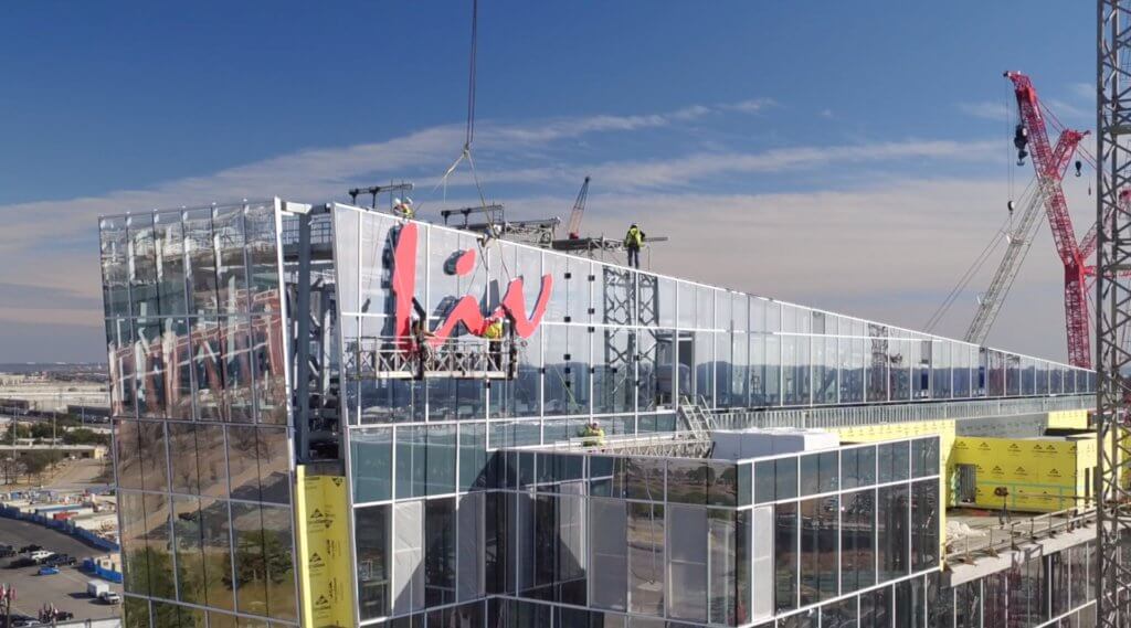
As a matter of fact, one of the new and novel applications for aerial drone photography involves the survey and assessment of nighttime exterior lighting for public facilities and private business locations. With almost instant image availability and an extremely low cost to operate, the lighting industry has been quick to adopt this approach to lighting assessment.
Seeing the Light
When it comes to aerial drones and the lighting industry, the match of evolving technology with industry needs seems to be a natural fit. It might seem obvious, but only at altitude can one see a complete picture of the current lighting conditions at a commercial location or public facility.
Through mapping and at-altitude photography, an accurate picture of what the current light levels are doing for a property, for buildings and cars, and other items under illumination can help lighting experts determine and plan an outdoor lighting project more accurately.
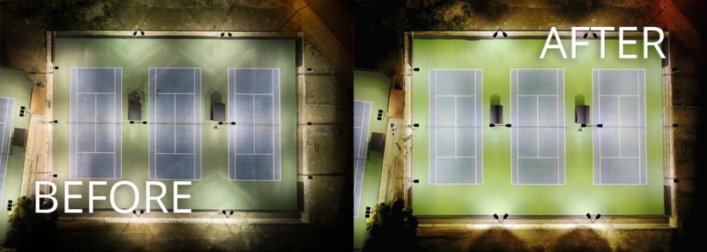
For example, being able to see how the current lighting lands on property lines from the air can help a designer plan the right fixture or lens application on the perimeter of a property to prevent light trespass. Furthermore, testing out several options and then taking pictures or videos of those options operating at night can confirm the right product choice and prevent costly changes later.
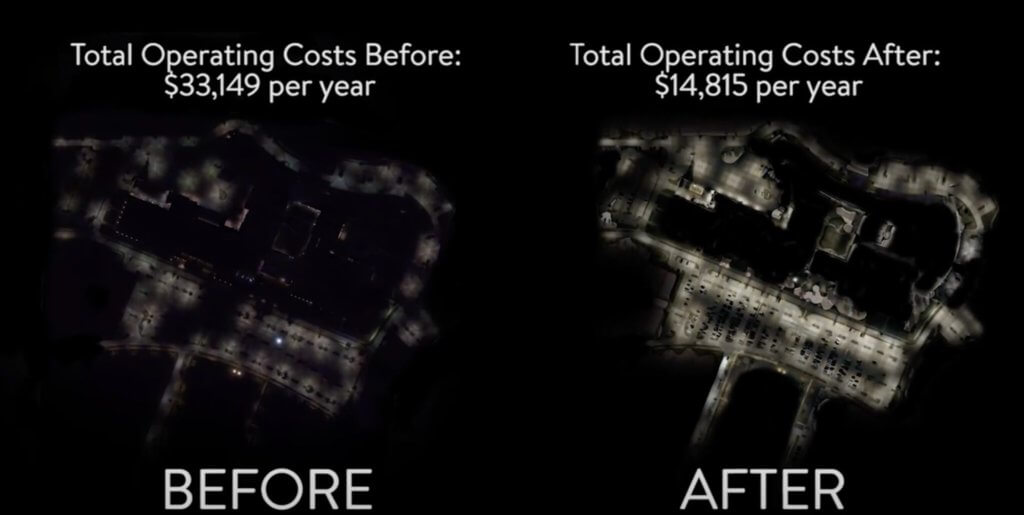
Additionally, just like the aerial drone can show the “before” conditions, it can also show the “after” conditions. This allows the lighting customer to clearly see that the project delivered on its promise!
Another way drone photography has become essential involves the development of accurate maps and measurements. Today’s drones can provide accurate surveying for a designer or planner. There are several readily available mapping applications that use GPS and altitude data to arrive at measurements within centimeters of accuracy, in some cases.
Drone Photography is Regulated
Even though almost anybody can quickly master the skills required to capture stunning aerial images, it is important to remember that drone photography is a federally regulated operation.
Drones, or as the Federal Aviation Administration (FAA) refers to them, Unmanned Aerial Systems (UAS), fall into two legal categories: hobby UAS and commercial UAS. While to a casual observer both types of drones might look the same, from a legal perspective they are very different.
The best way to know if the drone flight is personal or commercial is if there is money involved. If someone is being paid to fly a drone, either by a company as a contractor or as an employee, it’s a commercial operation.
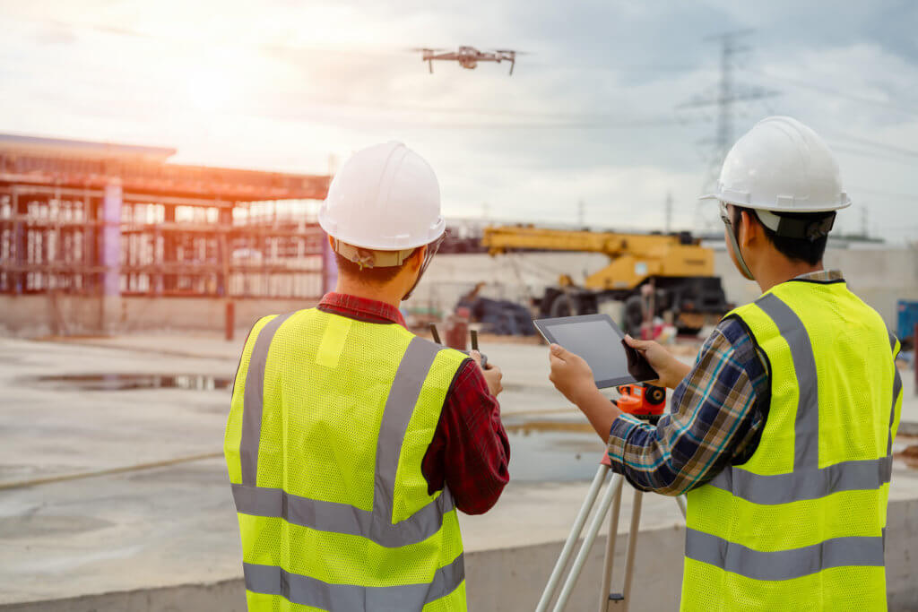
This means that the person flying must have a UAS Remote Pilot Certificate, or be in the presence and under the supervision of a certified individual and that the UAS being used has to be registered with the FAA. The process to get trained and licensed isn’t costly; however, getting caught operating a drone for a commercial application without a certificate is.
Drones Aren’t Cheap
A good commercial-grade drone is going to cost several thousand dollars, with motion picture-quality models reaching into the tens of thousands of dollars and more. There are lower-cost options out there, but when it comes to safety and capability, getting a bigger bird will almost always pay off in the long run.
Another cost to consider involves the drone pilot. In order to fly a UAS commercially, the flight operation has to be performed or monitored by a Pilot In Command with a Remote Pilot Certificate. The cost to get and maintain this certificate is not terribly high, and in fact, would be negligible for most companies.
However, the real cost comes in the form of moving that person from one project to another. This cost can amount to several thousand dollars depending on locations and durations, so it has to be considered on the front end when planning and budgeting for a drone photography project.
Ingram Park Mall: Parking Lot Lighting Retrofit Video Case Study w/ Drone Footage
Overall, a good UAS program is not cheap to implement, but with planning the costs can be managed and the results are far less expensive than alternative solutions. For example, a helicopter and pilot can easily cost several thousand dollars for each flight, and paying a survey company to map a potential project that may not have even been sold yet is certainly not a fiscally responsible option.
However, a good UAS program provides all of these functionalities at a fraction of the cost, not to mention the added benefit of marketing material that can be developed from the images and shared after the project is done!
We See the Big Picture with Drone Photography
Drone photography is here to stay, and at FSG we see UAS photography as an important tool that helps us deliver lasting value to our customers. For us, drone photography has proven time and again to be a quick and easy tool that makes lighting projects go smoother for both contractors and customers.
Beginning in 2014, FSG started using UAS technology to support outdoor lighting projects across the country. Our estimators and designers rely on the images to provide our customers with every available option to meet their site-specific requirements. After each project is completed, we love to fly the drone again so we can see the transformation we delivered to our customers.
Want to get a UAS flying on your project? FSG can help. Click here or call (877) 293-6689 and FSG will connect you with a resource that can help get a drone in the air above your school, hospital, auto dealership, or commercial facility.

